
Understanding Garden Land Surveys
Garden land surveys are an essential tool for property owners, developers, and landscape architects seeking to optimize their outdoor spaces. These surveys provide detailed information about the land’s topography, including its elevation, contours, and natural features. By understanding the layout and characteristics of the garden area, stakeholders can make informed decisions regarding landscaping, construction, and maintenance. When exploring options, Garden land survey services can provide comprehensive insights to ensure the best outcomes for your project.
What is a Garden Land Survey?
A garden land survey, often referred to as a topographical survey, is a precise and detailed mapping of a garden or outdoor space. This type of survey captures both natural and man-made features, including trees, shrubs, ponds, fences, and existing structures. The primary aim is to produce an accurate representation of the land’s physical characteristics, which is crucial for future planning and development.
Why You Need a Garden Land Survey
There are several compelling reasons to obtain a garden land survey, such as:
- Planning New Installations: Whether building a gazebo, installing a swimming pool, or creating a new landscape design, an accurate survey is fundamental for ensuring that your project aligns with the terrain.
- Identifying Drainage Issues: Understanding the elevation and contour of the land can highlight potential drainage problems, allowing you to design landscaping that mitigates flooding or erosion.
- Local Authority Regulations: Many local authorities require topographical surveys as part of building or landscaping permit applications.
Who Benefits from a Garden Land Survey?
Various stakeholders can benefit from a garden land survey:
- Homeowners: For those considering renovations or landscape transformations, a survey offers insights that help avoid costly mistakes.
- Landscape Architects: Professionals need detailed land information to create designs that work harmoniously with the natural environment.
- Contractors: Accurate surveys assist contractors in executing projects that adhere to the original design while accounting for site-specific challenges.
Essential Tools for Conducting Garden Land Surveys
Modern Survey Equipment Explained
Today’s garden land surveys employ advanced technology to ensure accuracy and efficiency. Here are some of the most common tools used in modern surveys:
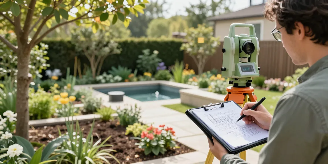
- Total Station Instruments: These devices combine electronic theodolites and distance measuring tools, enabling precise angle and distance measurements.
- GPS Surveying Equipment (GNSS): Global Navigation Satellite Systems provide quick and accurate positioning, particularly beneficial for expansive sites.
- 3D Laser Scanners (LiDAR): This technology can capture millions of data points within seconds, providing detailed three-dimensional representations of the landscape.
- UAVs (Drone Surveys): Drones equipped with high-resolution cameras allow surveyors to map hard-to-reach areas from above, collecting data efficiently.
- Digital Level Instruments: Essential for measuring vertical changes in height, which is crucial for creating accurate contour maps.
Topographic Maps and Their Importance
Topographic maps serve as a vital deliverable from a garden land survey. They illustrate the various elevations and contours of the land, providing visual context for architects and builders. This information is crucial when planning landscaping features, as it highlights any slopes, depressions, or significant variations in the landscape.
Using Technology to Enhance Accuracy
Integrating technology in garden land surveying enhances the accuracy and efficiency of the process. Digital tools allow for real-time data collection and analysis, reducing the likelihood of human error. Additionally, advanced software can process data to create high-resolution 3D models that provide a comprehensive overview of the site.
Preparing for Your Garden Land Survey
Site Assessment and Preparation
Before a garden land survey can commence, thorough site assessment and preparation are necessary. This includes:
- Identifying access points for surveyors and equipment.
- Clearing obstructions that may hinder the surveying process.
- Discussing specific requirements and objectives with your survey provider.
Identifying Key Features and Boundaries
During the preparation phase, it’s vital to identify any pertinent features and boundaries that will be included in the survey. This may involve marking existing structures, plants, and other relevant elements that will influence the survey results and subsequent planning decisions.
Common Challenges in Garden Surveys
Garden land surveys can encounter several challenges, including:
- Uneven Terrain: Landscapes with significant elevation changes can complicate data collection.
- Dense Vegetation: Heavy plant cover may obstruct clear views of the ground and limit accessibility.
- Weather Conditions: Poor weather can disrupt surveying operations and affect data accuracy.
Cost Considerations for Garden Land Surveys
Average Pricing for Garden Surveys in the UK
The cost of a garden land survey can vary widely based on several factors. Typically, small residential surveys start around £450 and can escalate to over £1,500 for larger commercial projects. It’s essential to request detailed quotes to understand the scope of services included.
Factors Influencing Garden Survey Costs
Several factors will influence the final cost of a garden land survey:
- Size of the Property: Larger areas naturally require more resources and time to survey.
- Complexity of the Landscape: Features such as slopes, water bodies, and structures add to the complexity.
- Required Deliverables: Customised reporting and data formats can increase costs.
Getting Quotes and Understanding Pricing Models
To ensure you receive a fair price for your garden land survey, it’s advisable to obtain multiple quotes. Understanding the pricing model of each provider, including any hidden fees or exclusions, will help you make an informed decision. Always clarify what is included in the quote to avoid unexpected costs later.
Future Trends in Garden Land Surveys for 2026
Emerging Technologies in Surveying
The landscape of garden land surveying is set to evolve significantly by 2026, driven by technological advancements. Increased use of artificial intelligence and machine learning will enhance data analysis and interpretation, leading to more precise surveys conducted in shorter timeframes.
Sustainability Considerations in Garden Design
As sustainability becomes more critical, garden land surveys will incorporate environmental impact assessments. Understanding soil types, local ecosystems, and sustainable landscaping practices will inform design choices and promote ecological harmony.
The Role of Drones in Modern Garden Surveys
Drones will continue to play a pivotal role in garden surveys, providing aerial views that offer unique insights into property layout and vegetation. Their ability to quickly cover large areas makes them a valuable asset for both residential and commercial surveying projects.
What are the Benefits of Garden Land Surveys?
Investing in a garden land survey has numerous benefits:
- Accurate Planning: Surveys provide reliable data that inform design and construction plans.
- Risk Mitigation: Identifying potential challenges early helps to avoid costly errors.
- Regulatory Compliance: Surveys are often required for planning permissions and other legal documentation.
How Long Does a Garden Land Survey Take?
The duration of a garden land survey depends on various factors, including the property’s size, complexity, and accessibility. Generally, surveys can be completed within a few hours for smaller gardens, while larger or more complex sites may take several days.
Can I Perform a Garden Land Survey Myself?
While it’s possible for individuals to conduct basic surveys using a measuring tape and grid paper, professional surveys are recommended. The accuracy, expertise, and technology employed by professionals ensure a reliable outcome that amateur efforts may not achieve.
What to Expect During a Garden Land Survey?
During a garden land survey, you can expect surveyors to arrive with specialized equipment and clearly defined objectives. They will assess the area, mark significant features, and gather data that will later be analysed to produce detailed reports and maps.
How Accurate Are Garden Land Surveys?
Professional garden land surveys offer a high degree of accuracy, often pinpointing measurements within a few centimetres. The precision of the equipment used, such as total stations and laser scanners, greatly enhances the reliability of the data collected.
What Happens After the Garden Land Survey?
Once the survey is complete, you will receive comprehensive reports and visual representations of your garden’s topography. This information can be used to inform landscaping decisions, support planning applications, and resolve property disputes.